Rotorua
With bleeding fingertips from the caving, I left Waitomo on 11 January and headed inland. Rotorua is the Maori and geothermal centre of New Zealand's North Island and a reputation preceded it - traditional, amazing and smelly. Yes, it's true - there's a rotten egg smell there from the abundance of sulphur from the geothermal and volcanic nature of the area. To be honest, you get used to it quickly but nevertheless, it's there.
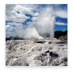
Rotorua is a nice town situated on Lake Rotorua over-shaddowed by volcanoes, some active. First stop after breakfast was a walk around town down by the lake - it's a nice place with lots of shops and restaurants. Once I had my bearings, I headed out of town to the Te Puia Maori site which is the traditional home of the Maoris and of the Price of Wales geyser ... the first of the geothermal experiences of New Zealand.
The traditional Maori customs and arts-and-crafts are on display - I got to see see and hear some Maori singing, witness a haka (off the rugby pitch) and them the geothermal wonders of the park. The geyser were erupting along with the bubbling mud pools and lakes, geysers spraying and even got to see two kiwis (the birds!). I was amazed at how big they were - they were chicken-sized and very endangered ... for some reason I thought they were much smaller and abundant.
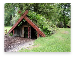
The Buried Village of Te Wairoa
Nobody would have believed in June 10 1886, that the serenity enjoyed by the inhabitants of Te Wairoa would be shattered by an outpouring of the Earth's fury. Few would have dreamed as the eighth wonder of the world - the fantastic Pink and White Terraces - sparkled in the moonlight, events deep in the ground were menacingly unfolding.
Te Wairoa Village, in a valley above Lake Tarawera, was established by a Christian Missionary in 1848. It was abandoned during the land wars of the 1860's, then repopulated a few years later as the staging post to the Pink and White Terraces. Violent and unexpected, the volcanic eruption was New Zealand's greatest natural disaster. For more than four terrifying hours, rocks, ash and boiling hot mud bombarded the peaceful village. The fiery glow in the night sky and the thunderous roar of the explosions were seen and heard as far away as Auckland.
In the gloom of the day, the wreckage of the hotels and houses, and the burial of 5000 square miles of scenic countryside brought awe and dismay to rescuers.
The eruption destroyed the Terraces and buried Te Wairoa and two smaller villages under hot heavy ash and mud. More than 150 lives were lost.
The geothermals of Wai-O-Tapu
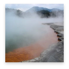
Wai-O-Tapu means "Sacred Waters" in Maori but this site is very special. Wai-O-Tapu is associated with volcanic activity dating back about 160,000 years and is located right on the edge of the largest volcanic caldera (depression) within the active Taupo Volcanic Zone. With the largest area of surface thermal activity of any hydrothermal system in the Zone, the Thermal Wonderland is the most active part of the 18 square km reserve and has at its northern boundary the volcanic dome of Maungakakaramea (Rainbow Mountain).
It is an area associated with the immense pressures attributable to the Indian – Australian Plate rising and overlapping the Pacific Plate causing a fault line which enables heat from below the earth’s crust to radiate upwards towards the surface and form geothermal features. In basic terms beneath the ground at Wai-O-Tapu is a system of streams which are heated by magma left over from earlier eruptions. The water is so super heated that it absorbs the minerals out of the rocks through which it passes and conveys them to the surface as steam where they are ultimately absorbed into the ground. The wide range of colours are all natural and are due to different mineral elements.
The uniqueness of the landscape is essentially attributed to land alteration through (1) Steam discharge (2) Acid-sulphate water (3) Alkali-chloride water.


